Sunday, April 12 | Pullman National Historical Park
A train ride to a town built by trains. NPS unit #249 is in the books!
With Alicia deep in conference sessions, I had the day to myself — and I had one destination in mind: Pullman National Historical Park. And fitting for a park steeped in railroad history, I got there the right way: aboard the Metra Electric train. Taking the train to Pullman isn’t just convenient — it’s part of the experience. Riding the rails into a neighborhood that was literally built around the railroad industry felt exactly right.
This was a new one for me — NPS unit #249! There’s always a special thrill walking into a national park site for the first time, and Pullman did not disappoint.
I started at the Administration Clock Tower Building, which houses the visitor center. The exhibits inside are genuinely excellent — telling the layered story of the Pullman company, the planned town George Pullman built for his workers in the 1880s, and the people who made it all run. A standout for me was the exhibit on the Pullman Porters — the predominantly Black workforce who staffed Pullman’s sleeping cars and played a pivotal role in the growth of the Black middle class and the labor movement in America. It’s a powerful and important story, and the park tells it well.
Just outside the visitor center, I explored the factory grounds — a mix of standing structures, atmospheric ruins, and interpretive railroad track installations that help you visualize the enormous industrial operation that once hummed here. At its peak, this was one of the largest manufacturing complexes in the country.
From there I walked over to Hotel Florence, currently undergoing restoration. Named after George Pullman’s daughter, the hotel was built to house Pullman’s distinguished guests and was the only place in the neighborhood where alcohol was served. Even mid-restoration, you can feel the elegance it once had.
I then wandered through the residential neighborhood — row after row of handsome red brick rowhouses that Pullman built for his workers. It’s remarkable how intact it all remains, and walking those streets gives you a real sense of what life in this planned utopian (and, critics would say, paternalistic) company town must have felt like.
Two more highlights rounded out the day: the striking Greenstone Church — built from serpentine stone and currently being lovingly restored — and the Pullman Firehouse, another beautifully preserved piece of this remarkable neighborhood.
Pullman is one of those places that surprises you. It’s not as well known as some of the marquee national parks, but the history here — of industry, labor, race, and the American working class — is as rich and relevant as anywhere I’ve visited. If you’re ever in Chicago, don’t skip it. 🚂
Next up: Day 5 — More Chicago adventures ahead. Stay tuned!
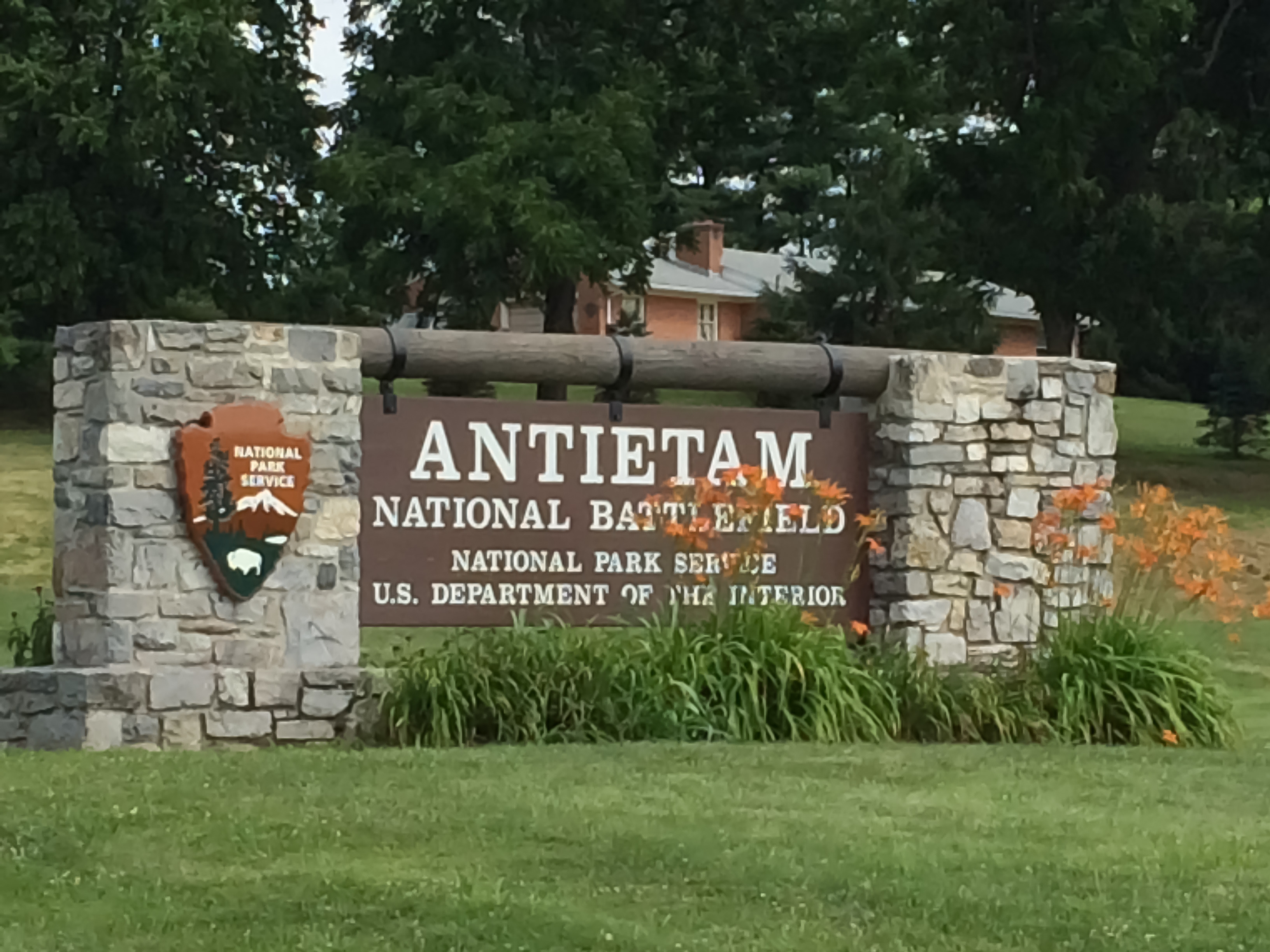
America’s Bloodiest Day — and the Morning That Changed Everything
▶ A Note from Ranger PamPaw
“There are places in this country where the ground itself seems to carry the weight of what happened there. Antietam is one of those places.”
September 17, 1862. A single day. More than 22,000 soldiers killed, wounded, or missing before the sun went down. The numbers alone are staggering — but the numbers don’t tell you what it felt like to walk those farm fields, to stand at Burnside Bridge and understand what it cost to cross it, or to look out over the Cornfield and try to comprehend what those men endured in less than three hours.
What makes Antietam different from most Civil War sites is how well it has been preserved. The landscape is remarkably intact. The farm fields, the sunken road, the creek crossings — they are still there, still recognizable. When you walk this ground, you are not imagining a battle. You are standing on it. That kind of connection to history is rare, and it deserves your full attention.
And then there is the bigger picture. The tactical outcome at Antietam was a draw. But it gave Lincoln the military footing he needed to issue the Emancipation Proclamation. The fate of slavery in America — and with it the soul of the Republic — turned on this one terrible day in a Maryland farm country. Go slowly when you visit. This place has earned it.
— Ranger PamPaw
▶ Quick Facts
Location
5831 Dunker Church Road, Sharpsburg, MD 21782 · Washington County, western Maryland
Established
1890 — one of the first four national military parks established by Congress
Size
3,230 acres of preserved battlefield, farmland, and river corridor
Admission
$10 per person (ages 16+); Annual Pass and America the Beautiful Pass accepted · Free for ages 15 and under
Visitor Center
Open daily 9 a.m. – 5 p.m. (extended summer hours) · Closed Thanksgiving, Christmas, and New Year’s Day
Phone
(301) 432-5124
Park Drive
8.5-mile self-guided auto tour with 11 marked stops — audio tour available via the NPS App
Trails
Approximately 8.5 miles of maintained hiking trails; mostly flat to gently rolling
Pets
Leashed pets permitted on all trails and in picnic areas; not permitted inside buildings
By the summer of 1862, Robert E. Lee had driven Union forces from the Virginia Peninsula and routed a Federal army at Second Bull Run. Sensing an opportunity to shift the war onto Northern soil — and perhaps earn British and French diplomatic recognition for the Confederacy — Lee led his Army of Northern Virginia across the Potomac into Maryland in early September.
A stroke of extraordinary luck changed the campaign’s trajectory. Union soldiers discovered a copy of Lee’s operational orders — Special Orders No. 191 — wrapped around three cigars in a Maryland field. The document revealed that Lee had divided his army. General George B. McClellan, commanding the Army of the Potomac, knew exactly where Lee’s forces were scattered. He had the chance to destroy them piecemeal. He moved — but not fast enough.
Lee managed to reunite most of his army near Sharpsburg, Maryland, with his back to the Potomac River. On September 17, McClellan attacked. The battle that followed was not a model of Federal coordination — attacks came piecemeal across three separate sectors of the field — but the fighting was savage at every point of contact.
Three Phases, One Day
The battle unfolded in three overlapping phases across the landscape you can still walk today:
The North Woods and the Cornfield (Morning): Fighting began around dawn in the East Woods and the 30-acre cornfield owned by farmer David Miller. Units charged and countercharged across the same ground repeatedly. In roughly two hours, approximately 8,000 men fell in and around that cornfield alone. Union General Joseph Hooker later wrote that the corn was cut as closely as could have been done with a knife — by musket fire.
Bloody Lane (Midday): A sunken farm road in the center of the Confederate line — worn down by years of wagon traffic — became a natural rifle trench. Confederate soldiers held it for nearly four hours against wave after wave of Union assaults. When it finally fell, the road was so choked with Confederate dead that witnesses said you could walk its length without stepping on the ground. History named it Bloody Lane.
Burnside Bridge (Afternoon): On the Union left, General Ambrose Burnside spent most of the day trying to cross a narrow stone bridge over Antietam Creek — defended by just a few hundred Georgia sharpshooters on the bluffs above. His forces finally crossed in the early afternoon and pushed toward Sharpsburg — only to be driven back by A.P. Hill’s Confederate division, which arrived at the last moment after a 17-mile forced march from Harpers Ferry.
When darkness fell, both armies held roughly the positions they had started with. More than 22,700 soldiers were killed, wounded, or missing. Lee retreated across the Potomac the following night. McClellan did not pursue.
▶ The Larger Meaning
The Emancipation Proclamation
Abraham Lincoln had been waiting for a Union military victory. He had drafted the Emancipation Proclamation months earlier but was advised not to issue it after a string of Federal defeats — it would look like an act of desperation. Antietam gave him the opening he needed.
Five days after the battle — on September 22, 1862 — Lincoln issued the preliminary Emancipation Proclamation, declaring that all enslaved persons in states still in rebellion would be “forever free” as of January 1, 1863. The final proclamation followed on New Year’s Day.
The political impact was immediate and far-reaching. It reframed the war’s purpose — from a conflict to preserve the Union into a crusade to end slavery. It made it nearly impossible for Britain or France to formally recognize the Confederacy, as both countries had abolished slavery and could not be seen siding with a slaveholders’ rebellion. And it opened the door for nearly 180,000 Black soldiers to serve in the Union Army, a force that would prove decisive in the war’s final years.
Antietam was not the end of anything. Terrible battles lay ahead. But the direction of the war — and the nation — shifted in those Maryland farm fields on September 17, 1862. That is why this ground matters.
▶ Touring the Battlefield
Start at the Visitor Center
The Henry Kyd Douglas Visitor Center should be your first stop. The museum inside provides essential context — particularly if you’re not already familiar with the Maryland Campaign. The 26-minute film Antietam Visit is well-produced and highly recommended before you head out onto the field. Rangers are available to answer questions and can help you prioritize based on your available time.
The 8.5-Mile Auto Tour
The self-guided driving tour follows the battle’s progression through 11 numbered stops, beginning at the Dunker Church and moving generally from north to south. Allow at least two hours if you plan to get out of your car at the major stops — longer if you want to walk any of the trails. The NPS App includes a free audio tour keyed to each stop.
Stop 1 — Dunker Church: The white-washed brick church of the German Baptist Brethren (a pacifist sect) became a landmark for both armies and changed hands several times during the battle. The restored building is a quiet, powerful place to begin.
Stop 2 — North Woods / The Cornfield: The open farmland where the battle’s first and most ferocious fighting erupted at dawn. A walking trail crosses the Cornfield and connects to the East and West Woods.
Stop 5 — Bloody Lane (Sunken Road): Walk the entire length of the sunken road — about a quarter mile. The observation tower at the east end provides a sweeping view of the central battlefield that is essential for understanding the day’s middle phase.
Stop 9 — Burnside Bridge: The three-arched stone bridge over Antietam Creek is one of the most photographed sites in the National Park System. A short loop trail takes you across the bridge and up to the Georgia sharpshooters’ firing positions on the bluffs — an eye-opening perspective on why those few hundred Confederates were able to hold it for hours.
Antietam National Cemetery: Located at the north end of the tour, the cemetery holds the remains of more than 4,700 Union soldiers. A solemn and important stop. (Confederate dead were largely buried in local church cemeteries and in Hagerstown’s Rose Hill Cemetery.)
▶ Trails & Walking Routes
Antietam offers approximately 8.5 miles of maintained foot trails. The terrain is mostly flat to gently rolling Maryland farmland — accessible for most visitors. Several trails connect directly to auto tour stops, making it easy to combine driving and walking.
Cornfield / North Woods Trail (approx. 1.5 mi.): Loops through the East Woods, the Cornfield, and the North Woods. Interpretive markers throughout. Best done in the morning when the light across the open fields is extraordinary.
Bloody Lane Trail (approx. 0.5 mi.): Follows the sunken road from Mumma Farm to the observation tower. Short, flat, and historically dense — don’t skip it.
Burnside Bridge Trail (approx. 1.3 mi.): Loops from the bridge parking area across Burnside Bridge, up to the Confederate bluff positions, and returns along Antietam Creek. The creek-side section is particularly pleasant in spring and fall.
Final Attack Trail (approx. 1.75 mi.): Traces the route of A.P. Hill’s division and Burnside’s late-afternoon advance. Less visited than the northern trails and a good choice for those who want a quieter walk.
▶ Know Before You Go
No food or gas inside the park. The town of Sharpsburg (immediately adjacent) is very small. Hagerstown, about 12 miles north, is the best base for dining, lodging, and services. Shepherdstown, WV (just across the Potomac) is a charming alternative with good restaurants and lodging.
September 17 is the battle’s anniversary. The park holds commemorative programs each year around the anniversary. It is also one of the busiest days of the year — plan accordingly.
Summer heat is real. There is almost no shade on the open battlefield. Bring water, wear sunscreen, and consider an early morning visit in July and August.
Ranger-led programs run seasonally. Walking tours of the Cornfield, Bloody Lane, and Burnside Bridge are offered on weekends from spring through fall. Check the park’s website or the NPS App for current schedules.
The C&O Canal towpath is adjacent to the park. The Chesapeake & Ohio Canal NHP runs along the Potomac River at the park’s southern edge. A short connector trail links the two sites — a worthwhile add-on for hikers and cyclists.
Photography. Dawn and dusk light on the open fields and Burnside Bridge are exceptional. The Cornfield in early morning mist is one of the most evocative landscapes on any Civil War battlefield.
Why This Place Matters
September 17, 1862 was the single bloodiest day in American military history — before or since. That fact alone demands our attention. But Antietam’s significance runs deeper than the casualty count.
Lee’s first invasion of the North failed here. British intervention on behalf of the Confederacy — which had seemed plausible just weeks earlier — became politically untenable. And Lincoln found his moment. Without Antietam, the Emancipation Proclamation may never have been issued — or at least not when it was, in the form it took, with the impact it had.
The battlefield is also a testament to preservation. Much of what you see today — the fields, the roads, the bridge, the church — survives in something close to its 1862 condition. That kind of landscape integrity is increasingly rare and genuinely fragile. It is worth protecting, and it is worth visiting with the care and attention it deserves.
Park Map
Official NPS map — Antietam National Battlefield · Sharpsburg, Maryland
Parks, perspective, and stories earned from a lifetime in the National Parks — from someone who was actually there. The Ranger PamPaw Podcast goes deeper on the history, the landscape, and the meaning behind the places that define America.
Where the Bloodiest Day in American History Meets Antietam Creek
The Burnside Bridge Trail at Antietam National Battlefield is one of the most historically charged short hikes in the National Park System. Starting at the iconic Lower Bridge — forever known as Burnside Bridge — the loop crosses Antietam Creek on the original 1836 stone span, then follows the east bank north along the Union Advance Trail to the remnants of an old mill dam and a quiet waterfall, before climbing back across the open battlefield to the parking area. It is a hike where every step echoes September 17, 1862 — the bloodiest single day in American military history.
Trail Facts
Distance: ~1.5 miles (loop)
Elevation Gain: ~80 feet — mostly gentle, one short climb on the return
Difficulty: Easy
Trail Type: Loop (paved path, gravel, and mowed grass)
Typical Hiking Time: 45–60 minutes
Accessibility: Paved path from parking area to the bridge is accessible; Union Advance Trail is natural surface
Pets: Allowed on leash
The Burnside Bridge area is one of several trail hubs within Antietam National Battlefield. The short paved path to the bridge alone is worth the stop for visitors of any ability level — the bridge and its overlook are among the most evocative spots on any Civil War battlefield.
Getting to the Trailhead
The Burnside Bridge parking area is located off Burnside Bridge Road in Sharpsburg, Maryland, approximately one mile south of the Antietam National Battlefield Visitor Center on Dunker Church Road. The Visitor Center is a highly recommended first stop — the film, museum exhibits, and battlefield maps provide essential context before you walk the ground. From the parking area, a short paved path leads directly down toward the bridge.
Antietam National Battlefield is located near Sharpsburg, Maryland — about 70 miles west of Baltimore and 70 miles northwest of Washington, D.C. — making it a natural destination for a day trip from either city or a stop along a broader Civil War trail tour through western Maryland.
Hiking the Trail
From the parking area, a short descent brings you to the west bank of Antietam Creek and the bridge approach. Before crossing, pause on the hillside. The position of the Confederate sharpshooters — tucked into the woods and bluffs on the west bank — becomes immediately clear from this vantage, and so does the problem facing the Union commanders who spent the better part of a morning trying to take this crossing.
Crossing the bridge itself is the centerpiece of the hike. The three-arch stone span, built in 1836, stretches about 125 feet over the creek. Walk it slowly — the stonework is original, the width is narrow, and the view downstream along the creek is exactly what soldiers on both sides saw that morning. Once across, the trail turns north onto the Union Advance Trail, a gentle path along the east bank of Antietam Creek in the direction Burnside’s Corps moved after finally securing the crossing. The creek runs alongside for much of the route, and the shaded, quiet character of this section stands in sharp contrast to its bloody history.
The trail reaches the remnants of an old mill dam — a low stone weir where water spills over in a gentle cascade — before the loop turns back uphill and returns across open ground to the parking area. The return leg crosses the rolling farmland of the battlefield, giving a broader view of the terrain Burnside’s troops were fighting toward after crossing the bridge.
Trail Map
Highlights Along the Way
Burnside Bridge
The Lower Bridge — universally called Burnside Bridge since the battle — was built in 1836 by the county as a simple farm crossing. On the morning of September 17, 1862, it became one of the most contested pieces of ground of the entire Civil War. Roughly 400 Georgian sharpshooters of Brigadier General Robert Toombs’s brigade held the west bank against repeated frontal assaults by Major General Ambrose Burnside’s IX Corps — some 12,000 men. The failed charges cost the Union dearly in time and lives. It took until roughly 1:00 PM for the 51st New York and 51st Pennsylvania regiments to finally force the crossing, having been promised a whiskey ration as inducement. The three-hour delay had consequences that rippled through the entire day’s outcome.
The Union Advance Trail and the Old Dam
The Union Advance Trail follows the east bank north from the bridge, retracing the ground over which Burnside’s Corps moved after finally crossing — pushing toward Sharpsburg and the Confederate right flank. The pace of that advance became its own controversy: had Burnside moved faster, he might have rolled up Lee’s right before A.P. Hill arrived. The trail’s most unexpected feature is the old mill dam, a remnant of the agricultural landscape that predated the battle. Water still spills over the stone weir, and the spot has a quietness to it that’s easy to linger over.
The Return Loop and the Open Fields
The return leg crosses the open ground above the creek valley — the same rolling farmland over which the afternoon’s fighting unfolded as Burnside’s troops pressed toward Sharpsburg, and then fell back when A.P. Hill’s division arrived from Harpers Ferry and struck the Union left flank. The battlefield landscape here has changed little since 1862, and that continuity gives the walk a particular weight.
What Makes This Trail Special
The Burnside Bridge Trail packs an extraordinary amount of history into a short walk. The bridge itself is one of the most recognizable structures in Civil War memory — and crossing it on foot, on the original stonework, gives visitors something no driving tour can replicate. The Union Advance Trail adds a dimension most visitors miss: the quiet creek corridor where a massive Union force reorganized after its costly morning, and the old dam waterfall that has nothing to do with the battle and everything to do with why you keep wanting to come back to places like this. The loop back across open farmland closes the story and leaves you with a full picture of what happened in this small corner of Maryland on September 17, 1862.
Tips for Visiting
Start at the Visitor Center — the museum and film provide context that makes the bridge crossing far more meaningful.
Walk across the bridge slowly. Read the interpretive markers. The width and the sightlines tell the story better than any description.
Wear sturdy shoes — the Union Advance Trail and the return loop are natural surface and can be muddy after rain.
Bring bug spray in warmer months — the creek corridor is prime mosquito territory.
Combine this stop with the full Antietam auto tour for the best understanding of the battle’s three phases and overall scope.
There is no food or water available at the Burnside Bridge stop; plan accordingly.
The Bloodiest Day — and What Followed
The Battle of Antietam on September 17, 1862 was the bloodiest single day in American military history — approximately 22,000 soldiers killed, wounded, or missing in roughly twelve hours of fighting. The battle unfolded in three distinct phases: the dawn assault at the Cornfield and Dunker Church in the north, the catastrophic struggle for the Sunken Road in the center, and the prolonged fight for the Lower Bridge in the south. Despite the staggering losses on both sides, the battle ended in tactical stalemate — but it was a strategic Union victory, turning back Robert E. Lee’s first invasion of the North.
That strategic outcome gave President Abraham Lincoln the moment he had been waiting for. Just five days after Antietam, on September 22, 1862, Lincoln issued the Preliminary Emancipation Proclamation. The bridge you cross on this trail stands at the edge of a day that did not just alter the course of the Civil War — it changed the war’s fundamental meaning.
Tuesdays on the Trail Video
This trail guide pairs with our Tuesdays on the Trail video episode, where we walk the Burnside Bridge Trail and explore the history of this remarkable crossing on Antietam Creek.
Final Thoughts
The Burnside Bridge Trail does not ask much — a mile and a half, an easy grade, less than an hour. What it gives in return is a direct, physical connection to one of the pivotal moments of the Civil War and of American history. You cross the same stones. You walk the same bank. You see the same creek. Antietam National Battlefield is one of the best-preserved Civil War sites in the country, and the Burnside Bridge Trail is one of the most powerful ways to experience it.
The Battle That Saved Washington · Frederick, Maryland
▶ A Note from Ranger PamPaw
“Most people drive right past Monocacy on their way to Gettysburg or Antietam. That’s a mistake worth correcting.”
Monocacy is one of those parks that quietly carries enormous weight. On a sweltering July day in 1864, a vastly outnumbered Union force made a stand here that bought Washington, D.C. the time it needed to be reinforced. The Confederates won the battle. But they lost their last real chance to change the war.
I’ve had the privilege of visiting hundreds of National Park Service units over the course of my career. What strikes me about Monocacy is how intact it feels. The farm fields, the river, the ridge lines — much of what you see today is what those soldiers saw. That’s rare. That’s worth your time.
— Ranger PamPaw
▶ Quick Facts
Location
4632 Araby Church Road, Frederick, MD 21704 · Maryland Route 355 / Urbana Pike, south of Frederick
Established
1934 — one of the earliest Civil War battlefields preserved by the federal government
Size
1,647 acres of preserved farmland, woodlands, and river corridor
Admission
Free — no entrance fee. Open year-round.
Visitor Center Hours
Thursday–Monday, 9 AM–5 PM · Closed Tuesday, Wednesday, Thanksgiving, Christmas, New Year’s Day
By the summer of 1864, the war had turned against the Confederacy on nearly every front. General Ulysses Grant had the Army of the Potomac grinding toward Richmond, and Sherman was pushing into Georgia. Confederate General Jubal Early was tasked with a bold diversionary mission: march his Army of the Valley down through the Shenandoah, cross into Maryland, threaten — or even capture — Washington, D.C., and force Grant to pull troops away from Richmond.
It was an audacious plan with real potential. Washington’s defenses had been stripped to feed the front lines. A Confederate force at the gates of the capital could have influenced the 1864 presidential election, potentially ending Lincoln’s administration and opening a path to peace on Confederate terms.
July 9, 1864 — The Stand at Monocacy Junction
General Lew Wallace commanded a scratch force of about 5,800 Union soldiers. Early’s Army of the Valley numbered nearly 15,000. Wallace knew he could not stop Early — but he could slow him down.
The fighting centered on the junction of the Baltimore & Ohio Railroad and the Monocacy River — a critical chokepoint on the road to Washington. Union forces held the ford crossings and the railroad bridge. Confederates eventually found an unguarded ford downstream, flanked the Union position, and broke the Federal line. The battle lasted most of the day.
The Union lost — but Wallace bought nearly 24 hours. When Early’s army finally reached the outskirts of Washington on July 11, they found Fort Stevens reinforced with troops rushed up from Grant’s lines. Early probed the defenses, concluded the city was now too strong, and withdrew. President Lincoln himself watched the skirmishing from the fort’s parapet — the only sitting president to observe combat during his administration.
📍 Why This Battle Matters
Monocacy is often called “The Battle That Saved Washington.” Without Wallace’s delay, Early’s army reaches a poorly defended capital on July 10 — before reinforcements arrived. The battle also preserved Lincoln’s ability to win reelection in November, which preserved the Union’s commitment to fighting the war to a complete conclusion. For a battle where the Union lost, its strategic consequences were enormous.
▶ What to See and Do
Start: The Visitor Center
The visitor center sits on the former Best Farm — the site where Confederate artillery was positioned during the battle. Begin here. The electric (light-animated) battle map program is the single best tool for understanding the day’s action before you head out onto the landscape. Plan 30–45 minutes inside.
Junior Ranger: Pick up a booklet here — available for all ages, no charge.
Passport Stamp: Ask rangers about the cancellation stamp and any bonus stamps available during your visit.
Ranger-led programs offered seasonally — check nps.gov/mono for the current schedule.
The Self-Guided Auto Tour
Approximately 4–6 miles round trip on public roads. Plan 90 minutes to two hours if you stop at each site. Follow the printed brochure map rather than GPS alone — the audio guide available via the website may not perfectly align with current stops.
The Gambrill Mill Trail at Monocacy National Battlefield is a short, accessible walk that packs a remarkable amount of Civil War history into half a mile. Starting at one of the battlefield’s most storied stops, the trail loops through open fields and along a boardwalk to an overlook of the Monocacy River — the site of critical bridge crossings that shaped the outcome of the Battle of Monocacy on July 9, 1864. This is a trail where every step covers ground that Union soldiers defended and retreating troops once crossed in desperation.
Accessibility: Boardwalk section (0.2 mile to the overlook) is wheelchair accessible
Pets: Allowed on leash
This is one of six walking trails at Monocacy National Battlefield and one of the most accessible. The boardwalk section alone — leading to the river overlook — is well worth the short walk for visitors of all ability levels.
Getting to the Trailhead
The Gambrill Mill Trail begins at Tour Stop #5 on the Monocacy National Battlefield auto tour. The entrance is located on the west side of Urbana Pike (Maryland Route 355), approximately 0.9 miles south of the main Visitor Center at Best Farm — and just under two miles south of downtown Frederick. Parking is available at the Gambrill Mill lot. Look for the wayside marker beside the parking area as your starting point.
Monocacy National Battlefield is easy to reach — about an hour from both Baltimore and Washington, D.C. — making this an ideal stop for a day trip or a longer battlefield tour.
Hiking the Trail
The trail begins near the Gambrill Mill building — the original 1830 grist mill, now used as NPS offices — and the grounds of Edgewood, the former estate on the property. From the parking area, the loop can be started in either direction.
The highlight of the trail is the boardwalk section, which extends 0.2 miles to an overlook above the Monocacy River. From this vantage point, you can see the stone columns of the original Baltimore and Ohio Railroad bridge to your left — the original stonework is still there, though the track is modern. To the right, the current Urbana Pike bridge marks the location where a wooden covered Georgetown Pike bridge once stood. Union troops burned that wooden bridge during the battle to slow the Confederate advance. The railroad bridge, too valuable to destroy, eventually fell into Confederate hands by the end of the day.
Beyond the overlook, the trail follows a mowed path around a large open field before cutting back across to the parking area.
Trail Map
Highlights Along the Way
The Gambrill Mill Building
The mill at the trailhead has a remarkable story. Built around 1830 and operated by James H. Gambrill — who purchased the property in 1855 — it was known as Araby Mills and was a productive grist mill serving the surrounding community. During the battle, Gambrill himself sheltered inside the mill with several companions under the waterwheel as fighting raged outside. Despite being under near-constant fire, the Federal army used the mill as a makeshift field hospital. Gambrill survived by selling flour to Union troops — a savvy move for a Southern sympathizer. The mill operated into the 1890s before the property eventually passed into public hands. It served as the Monocacy National Battlefield Visitor Center until 2007, when frequent flooding prompted the move to Best Farm.
The River Overlook and the Bridges
The boardwalk overlook is the centerpiece of this trail. On July 9, 1864, this stretch of the Monocacy River was a critical defensive line for Union forces under General Lew Wallace. Confederate General Jubal Early initially planned to force a crossing here — at both the wooden Georgetown Pike bridge and the B&O Railroad bridge. Union defenders made that crossing costly enough that Early eventually shifted his attack southwest to Worthington Ford. The railroad bridge, which was too vital to destroy, was captured by Confederate forces by day’s end. Standing at this overlook, the tactical logic of the battle becomes strikingly clear.
The Open Fields
The mowed loop around the open field following the overlook traces the ground where retreating Union soldiers ran as the Confederate army pressed its advantage at the end of the battle. The battlefield landscape has changed little since 1864, and that continuity is part of what makes Monocacy such a powerful place to visit.
What Makes This Trail Special
The Gambrill Mill Trail may be the shortest trail on the battlefield, but it connects visitors directly to some of the battle’s most pivotal moments. The combination of the historic mill building, the river overlook with its original bridge infrastructure still visible, and the open fields where the fighting unfolded makes this a surprisingly rich half-mile. It is also one of the most accessible experiences in the National Park System — the boardwalk alone gives visitors of nearly any ability level a meaningful connection to this history.
Tips for Visiting
Wear waterproof shoes or boots after rain — the earthen sections of the trail can be muddy and hold standing water.
If conditions are wet, the boardwalk out-and-back to the overlook is the smarter choice — and it’s the best part of the trail anyway.
Bring bug spray in warmer months — the river corridor attracts mosquitoes.
Combine this stop with the full Monocacy auto tour for the best understanding of the battle’s scope and significance.
Picnic tables are available near the mill — a great spot for a rest between stops.
There is no food or water available at this stop; plan accordingly.
The Battle That Saved Washington
The Battle of Monocacy on July 9, 1864 is one of the most consequential one-day battles of the Civil War — even though the Union lost. General Lew Wallace’s outnumbered forces delayed General Jubal Early’s Confederate army long enough that Union reinforcements were able to reach the defenses of Washington, D.C. before Early could strike. Had Monocacy not been fought, the capital might well have fallen. The battlefield is often called “the battle that saved Washington,” and the Gambrill Mill stop is one of the clearest windows into how that day unfolded along the river.
Tuesdays on the Trail Video
This trail guide pairs with our Tuesdays on the Trail video episode, where we walk the Gambrill Mill Trail and explore the history of this remarkable stretch of the Monocacy River.
Final Thoughts
The Gambrill Mill Trail does not ask much of visitors in terms of distance or effort — but it gives a great deal in return. In half a mile, you walk from a mill that sheltered civilians under fire, to a river overlook where the outcome of a battle — and perhaps the fate of a nation’s capital — hung in the balance. Monocacy National Battlefield is one of the most undervisited sites in the Civil War park system, and the Gambrill Mill Trail is one of the best reasons to stop.
The Overlook Ridge Trail is the return option that changes how you understand Fort Bowie. Instead of retracing your steps, this route climbs above the fort and rewards you with sweeping views across Apache Pass—showing why this location mattered, and how carefully it was chosen.
It’s a more exposed and more strenuous way back to the trailhead, but the perspective it provides is hard to match.
Trail Overview
Trail Name: Overlook Ridge Trail
Park / Site: Fort Bowie National Historic Site
Location: Ridge above the fort ruins; reconnects with the main route to the trailhead.
Distance: Third-party estimates commonly place this segment around ~1.2–1.3 miles (varies by mapping source)
Difficulty: More strenuous than the main route (steeper, more exposed)
Best Use: As a return route to form a loop with the Fort Bowie Access Trail
Where the Overlook Ridge Trail Fits
Most visitors reach Fort Bowie by hiking the main access route through Apache Pass. From the fort area, the Overlook Ridge Trail provides an alternate return that climbs above the site and reconnects with the main trail closer to the trailhead.
Hiking the Ridge
The climb is where you feel the difference: the route is steeper and more exposed, and the ridge puts you out in the open where sun and wind are part of the experience. In return, you gain the big-picture view—looking down on the fort and across the surrounding landscape.
Trail Map
Highlights Along the Way
High-angle views looking down on the fort ruins.
Wide views across Apache Pass and surrounding mountain ranges.
A stronger sense of why this site was strategically located.
What Makes This Trail Special
The Overlook Ridge Trail is about perspective. The main route brings you into the story through artifacts and landscape; the ridge brings you above the story and shows you the geography that shaped it. Together, the two trails make a loop that feels complete. [1](https://www.mypacer.com/routes/oi4b6v/overlook-ridge-trail-hiking-bowie-arizona)
The Fort Bowie Access Trail is one of those hikes where the walk is inseparable from the place you’re visiting. Fort Bowie is a hike-in historic site reached on foot through Apache Pass, and that approach puts the story in the landscape long before you reach the fort ruins.
Along the way, you pass layers of history—including the ruins of the Butterfield Overland Mail stage station and a small cemetery—before arriving at the broad hillside of fort foundations and interpretive areas.
Trail Overview
Trail Name: Fort Bowie Access Trail
Park / Site: Fort Bowie National Historic Site
Location: Near Bowie, Arizona (Apache Pass)
Distance: ~1.5 miles one way to the fort / visitor center (about ~3 miles round trip)
Difficulty: Easy to Moderate (sun exposure; uneven footing in places)
Trail Type: Out & back (or combine with Overlook Ridge for a loop option)
Typical Hiking Time: ~2–3 hours round trip plus time exploring the ruins
Getting to the Trailhead
Getting to the Fort Bowie trailhead is part of the experience. From the highway, you follow an unpaved road through Apache Pass to the parking area. From there, Fort Bowie is reached on foot.
Tip: Cell service can be limited in remote areas. Download maps ahead of time, start earlier in the day, and carry water—especially in warmer months.
Hiking the Trail
The walk in is about a mile and a half one way, and it does something few park sites do: it slows you down and places the story in the landscape before you ever reach the ruins.
Along the trail, you pass the remains of the Butterfield Overland Mail stage station—an important stop along a transcontinental route—and then the post cemetery, a quiet reminder of the human cost of life and conflict in this place.
Fort Bowie was established to protect Apache Pass and Apache Spring, a reliable water source that made this area strategically important. The fort and surrounding landscape became central to the conflict between the U.S. Army and the Chiricahua Apache during the Apache Wars.
Trail Map
Highlights Along the Way
Apache Pass landscapes and big-sky desert views.
Butterfield stage station ruins (wide views and close detail)
Post cemetery and interpretive waysides
Fort foundations spread across a broad hillside
History & Context
Fort Bowie preserves the story of a landscape shaped by travel, water, and conflict. Today, the National Park Service describes the fort and visitor center as accessed by a three-mile scenic loop hike through the historic ground of Apache Pass.
What Makes This Trail Special
The Access Trail makes Fort Bowie feel earned. The approach builds context—stage route ruins, cemetery, water source, and landscape—so when you finally stand among the foundations, the place makes sense in a deeper way.
Tips for Visiting
Water & sun: carry water and sun protection—shade can be limited.
Footing: expect uneven sections and desert wash crossings.
Time: allow extra time for waysides, ruins, and the visitor center area.
Watch the Trail on Tuesdays on the Trail
This trail guide pairs with our Tuesdays on the Trail episode on Fort Bowie—walking the route through Apache Pass and exploring the ruins.
Apache Pass, Arizona · Dos Cabezas Mountains · Est. 1972
▶ A Note from Ranger PamPaw
“Fort Bowie is intentionally off the beaten path — and that’s exactly the point. This is a historic site you earn.”
Fort Bowie National Historic Site sits in historic Apache Pass in southeastern Arizona — reachable only by a drive on an unpaved road followed by a walk-in trail through the pass itself. There is no driving to the ruins. There is no shuttle. You approach on foot through the same terrain that made this corridor worth fighting over for three decades. The NPS is not wrong when it says getting here is half the adventure.
This is one of the most consequential landscapes in the history of the American Southwest, and it is almost entirely unchanged from what it looked like during the conflicts that defined it. Wide open, exposed, and quiet in a way that forces you to reckon with what happened here. This guide adds the historical context and practical planning details to help you make the most of your visit.
— Ranger PamPaw
▶ Quick Facts
Designation
National Historic Site
Established
August 30, 1972
Location
Apache Pass, southeastern Arizona — accessible via unpaved Apache Pass Road from Bowie (I-10) or AZ-186 near Chiricahua National Monument
Size
1,000 acres
Admission
Free — no entrance fee
Access
Unpaved road to trailhead; fort ruins and visitor center reached on foot — no vehicle access to the historic site
Park Hours
Grounds open sunrise to sunset daily; visitor center hours vary — check nps.gov/fobo for current hours
Trail
3-mile scenic loop (walk-in only); approximately 1.5 miles one way to the fort and visitor center
Nearby
Chiricahua National Monument (~25 miles south via AZ-186); Willcox, AZ for lodging and services
Apache Pass cuts through the Dos Cabezas Mountains in southeastern Arizona, connecting the San Simon Valley to the east with the Sulphur Springs Valley to the west. In the mid-nineteenth century it was the most direct route across this stretch of the Southwest — and it held something more valuable than the route itself: Apache Spring, a reliable source of water in a landscape where water meant survival. The Butterfield Overland Mail Company recognized this and routed its stage line through the pass in 1858, watering horses and passengers at the spring on the long run between St. Louis and San Francisco.
The Chiricahua Apache had known the value of this pass long before the Butterfield stages arrived. It was part of their ancestral territory, and Apache Spring was a resource they had depended on for generations. The collision of these two claims — an expanding United States demanding open access to the pass, and the Chiricahua Apache defending their homeland — is the central story of Fort Bowie.
The Bascom Affair and the Battle of Apache Pass
The spiral toward open conflict began in January 1861 with what became known as the Bascom Affair. Lieutenant George Bascom, acting on a rancher’s false accusation, attempted to detain Chiricahua chief Cochise at Apache Pass. Cochise escaped, but the confrontation that followed — hostage-taking and killings on both sides — shattered a period of relative peace and ignited a conflict that would last for decades. Cochise, who had previously maintained a working relationship with American settlers, became one of the most determined and effective resistance leaders in the Southwest.
The following year, in July 1862, a column of Union soldiers moving east through Apache Pass to confront Confederate forces in New Mexico was ambushed by a large force of Chiricahua Apache under Cochise and Mangas Coloradas at the Battle of Apache Pass. The Army prevailed with the use of howitzers — artillery that the Chiricahua had not faced before — but the battle demonstrated how strategically critical the pass had become. Construction of Fort Bowie began almost immediately, its purpose to hold Apache Spring and keep the pass open for military operations and emigrant travel.
Three Decades of Conflict: Cochise, Geronimo, and the End
The first Fort Bowie was little more than a camp. A second, more substantial post was built in 1868 on a plateau above the original site, with adobe barracks, officer quarters, a hospital, and other structures of a functioning frontier community. For more than 30 years, the fort and its surrounding pass were the center of gravity for U.S. Army operations in the region. The conflict went through periods of intense fighting, brief negotiation, and uneasy peace. Cochise — who had long operated from the impregnable Cochise Stronghold in the Dragoon Mountains, visible on clear days from the fort — negotiated a reservation agreement in 1872 that included the Chiricahua homeland. He died in 1874.
The conflict did not end with Cochise. Geronimo — whose resistance became the defining chapter of the final phase of the Apache Wars — surrendered for the last time in 1886, bringing the military campaign centered on this pass to a close. In a decision that remains deeply controversial, the U.S. government then removed not only Geronimo’s band but all of the Chiricahua Apache — including those who had served as Army scouts — to Florida and Alabama as prisoners of war. They were never permitted to return to their Arizona homeland. Fort Bowie was abandoned in 1894, its purpose fulfilled.
▶ The Walk In: A Hike Through History
The Fort Bowie experience is defined by the walk in. There is no road to the ruins — access is by foot only, along a 3-mile scenic loop that begins at a trailhead parking area on Apache Pass Road. The trail is well-marked with interpretive stops that layer the history as you move through the pass. Most visitors walk in and out on the main trail (approximately 1.5 miles each way), with the option to return via the steeper Overlook Ridge Trail for broader views of the surrounding mountains.
Key Stops Along the Trail
Butterfield Stage Station ruins — Among the first stops on the trail, these remnants of the mid-19th-century stage route remind you that this pass was a commercial corridor before it became a military one. The Butterfield Overland Mail operated through here from 1858 to 1861, carrying passengers and mail on a 2,800-mile route linking St. Louis to San Francisco.
Apache Spring — The water source at the heart of the entire conflict. The spring flows year-round in this otherwise arid landscape, and standing at it makes immediately clear why both the Chiricahua Apache and the U.S. Army considered it worth fighting over. A Chiricahua Apache wickiup reconstruction near the spring adds further context.
Post cemetery — A quiet, sobering stop on the trail. The graves here represent the human cost of a remote and difficult posting — soldiers, civilians, and others whose lives intersected with this pass during its three decades of conflict.
Fort Bowie ruins and visitor center — The trail ends at the ruins of the second Fort Bowie, where approximately 40 adobe structures once stood. Low wall remnants mark the footprints of barracks, officer quarters, the hospital, and other buildings. Photographs at each site show how the structures looked when occupied. The small visitor center holds exhibits on the fort’s history and the broader Apache Wars. See our dedicated Fort Bowie Access Trail Guide for the full trail breakdown.
▶ Know Before You Go
Getting There
The trailhead parking area is reached via Apache Pass Road — an unpaved graded road accessible from either Interstate 10 near the town of Bowie (from the north) or from AZ-186 just north of the entrance to Chiricahua National Monument (from the south). The unpaved section is approximately 8 miles from AZ-186. The road is generally passable for standard passenger vehicles in dry conditions; check current road conditions before visiting, especially after rain. Fort Bowie and Chiricahua National Monument are natural companions — the two parks are about 25 miles apart and make an excellent two-day combination.
What to Bring
Much of the trail crosses open, exposed terrain with limited shade. Water and sun protection are not optional — bring more water than you think you need, especially from late spring through early fall when temperatures in the pass can be intense. Sturdy footwear with good traction is recommended; the trail surface varies from packed dirt to rocky uneven ground. There is no food or water service at the site. The monument has picnic facilities at both the trailhead and the visitor center.
Plan Your Time
Allow a minimum of two hours for the walk-in experience — one hour in, one hour out — with additional time at the ruins and visitor center. The experience rewards a slow pace: the interpretive stops along the trail build the story progressively, and the ruins make more sense if you’ve read the context before you arrive at them. Morning visits are recommended to avoid peak afternoon heat and to have the pass at its quietest. No camping is available within the monument; the nearest lodging is in Willcox, approximately 20 miles north on I-10.
Why This Place Matters
Apache Pass and its springs were among the most strategically important landmarks in the 19th-century Southwest. The conflict centered here — three decades of war, negotiation, and ultimately forced removal — permanently shaped the history of the region and the lives of the Chiricahua Apache people, whose descendants are still present today. Fort Bowie preserves not just the ruins of a military post but the landscape itself: the same terrain, the same spring, the same sightlines that made this pass worth fighting over.
The walk-in requirement is not an inconvenience — it is the point. Arriving on foot through Apache Pass, the way everyone arrived here for three decades of conflict, changes how the ruins read when you reach them. This is one of the few places in the National Park System where the approach itself is the interpretive experience. That combination of authentic landscape and genuine history makes Fort Bowie one of the most underrated sites in the Southwest.
▶ Park Map
▶ First Encounters
Watch Ranger PamPaw’s First Encounters episode for Fort Bowie National Historic Site — the drive into Apache Pass, the walk-in trail, and what it feels like to arrive at the ruins of a fort that defined the final chapter of the Apache Wars.
The Echo Loop Trail, often called the Echo Canyon Loop, is one of the best ways to experience the heart of Chiricahua National Monument’s “Wonderland of Rocks.” This moderate loop takes you through narrow rock corridors, shaded grottoes, and wide-open views filled with towering pinnacles and balanced rocks.
This is a trail that rewards patience. Instead of a single destination, the experience builds gradually as the landscape shifts around you—sometimes open and expansive, sometimes tight and intimate.
Trail Overview
Distance: ~3.4 miles (loop)
Elevation Change: ~560 feet
Difficulty: Moderate
Trail Type: Loop
Typical Time: 2–4 hours
Getting to the Trailhead
The Echo Loop Trail begins at the Echo Canyon parking area, reached by driving the paved Bonita Canyon Road through Chiricahua National Monument. The drive itself is scenic, climbing through oak, pine, and cypress forests.
Parking and pit toilets are available near the trailhead, but there is no water. During busy seasons, especially late winter and spring, the lot can fill quickly.
Hiking the Trail
Most hikers choose to hike the loop counterclockwise, starting down the Echo Canyon Trail. This direction offers a more comfortable descent and saves the sustained climb for the end.
The descent into Echo Canyon is immediate and immersive. Towering rhyolite pinnacles rise on both sides as the trail winds through narrow passages and shaded rock corridors. One of the highlights is the Grottoes—tunnel-like openings carved into the rock.
The loop then transitions to the Hailstone Trail, where views open across the Wonderland of Rocks and desert plants like yucca, agave, and cactus thrive on sunnier slopes. The final leg follows the Ed Riggs Trail, climbing steadily back toward the trailhead.
Trail Map
Highlights Along the Way
Narrow canyon corridors surrounded by rock pinnacles
The Grottoes and tunnel-like formations
Wide views across the Wonderland of Rocks
Changing vegetation from desert plants to forested sections
History & Context
The landscape at Chiricahua was shaped by massive volcanic eruptions millions of years ago, followed by long periods of erosion. Much of the trail infrastructure was built by the Civilian Conservation Corps in the 1930s, whose stonework still guides visitors through this rugged terrain.
What Makes This Trail Special
What sets the Echo Loop Trail apart is how immersive it feels. Rather than viewing formations from a distance, you walk directly among them—sometimes in wide-open views, other times in narrow passages where the rocks rise on both sides.
Tips for Visiting
Wear sturdy hiking shoes with good traction
Bring plenty of water; none is available on the trail
Morning and late afternoon offer cooler temperatures
Expect uneven footing and occasional exposure near drop-offs
Watch the Trail on Tuesdays on the Trail
We hiked the Echo Loop Trail as part of our visit to Chiricahua National Monument and featured it on Tuesdays on the Trail, walking through the loop and sharing what it’s like to experience the Wonderland of Rocks on foot.
Coming March 17, 2026
Final Thoughts
The Echo Loop Trail offers one of the most complete trail experiences at Chiricahua National Monument. In just a few miles, it captures the variety, scale, and quiet wonder that define this remarkable landscape.
Explore More with Tezels on the Road
Find more trail guides, videos, and travel stories from our journeys through national parks and public lands.
Used to determine whether a user is included in an A / B or Multivariate test.
18 months
_ga
ID used to identify users
2 years
_gali
Used by Google Analytics to determine which links on a page are being clicked
30 seconds
_ga_
ID used to identify users
2 years
_gid
ID used to identify users for 24 hours after last activity
24 hours
_gat
Used to monitor number of Google Analytics server requests when using Google Tag Manager
1 minute
_gac_
Contains information related to marketing campaigns of the user. These are shared with Google AdWords / Google Ads when the Google Ads and Google Analytics accounts are linked together.
90 days
__utma
ID used to identify users and sessions
2 years after last activity
__utmt
Used to monitor number of Google Analytics server requests
10 minutes
__utmb
Used to distinguish new sessions and visits. This cookie is set when the GA.js javascript library is loaded and there is no existing __utmb cookie. The cookie is updated every time data is sent to the Google Analytics server.
30 minutes after last activity
__utmc
Used only with old Urchin versions of Google Analytics and not with GA.js. Was used to distinguish between new sessions and visits at the end of a session.
End of session (browser)
__utmz
Contains information about the traffic source or campaign that directed user to the website. The cookie is set when the GA.js javascript is loaded and updated when data is sent to the Google Anaytics server
6 months after last activity
__utmv
Contains custom information set by the web developer via the _setCustomVar method in Google Analytics. This cookie is updated every time new data is sent to the Google Analytics server.